KRISHI VIGYAN KENDRA, MUNGELI (C.G.)
INDIRA GANDHI KRISHI VISHWAVIDYALAYA, RAIPUR (Chhattisgarh)
ICAR-Agricultural Technology Application Research Institute,Adhartaal Jabalpur (M.P.)
District Profile of Mungeli
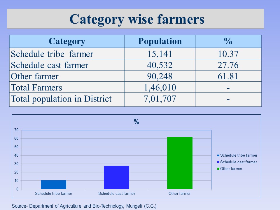
Mungeli is one of the most important potential district of Chhattisgarh in terms of area, production and productivity of different crops. Mungeli comes under Chhattisgarh plane region of the state. Total geographical area of district is 2.75 lakh ha. Total cultivated land comes under Mungeli district is 2.34 lakh ha. Nearly 47.30 % area comes under irrigated condition during rabi season and after rice crop utera cultivation is dominant. Mungeli district is comprised of 03 blocks namely Mungeli, Lormi and Pathariya and farmers family is 146010 . Average rainfall of the district is 1071 mm per annum. In Mungeli district there is a low productivity of various crops. This is due to non adoptability of recent agricultural technology and also due to lack of use of improved crop variety seeds, irrigation facilities, poor soil fertility level etc..
DISTRICT PROFILE (2018-19)
Agro-climatic Zone |
Chhattisgarh Plain |
Geographical area (ha) |
2,75,036 |
Forest area (ha) |
1,11,094 |
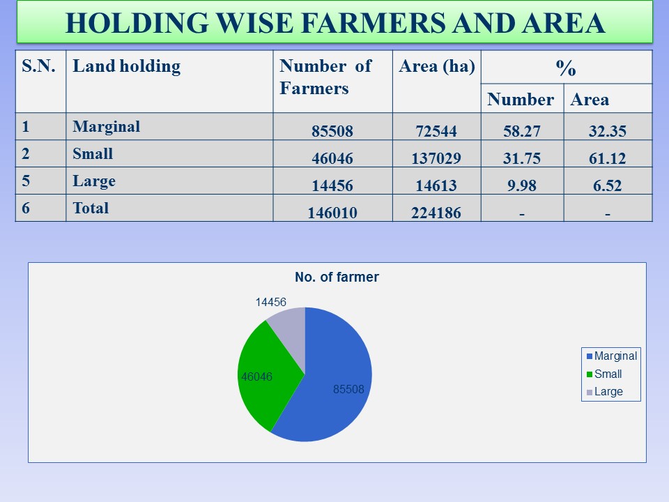
Net cultivated area (ha) |
2,24,186 |
Kharif sown area (ha) |
2,23,504 |
Rabi sown area (ha) |
1,23,583 |
Seed Replacement Rate |
60.7% |
Fertilizer Consumption |
NPK kg/ha (Total 112.4 kg) |
Cropping Intensity (%) |
183.26% |
Irrigation (%) |
54.5% |
Avg. rainfall |
1071 mm |
Average size of land holding |
2.0 acre |
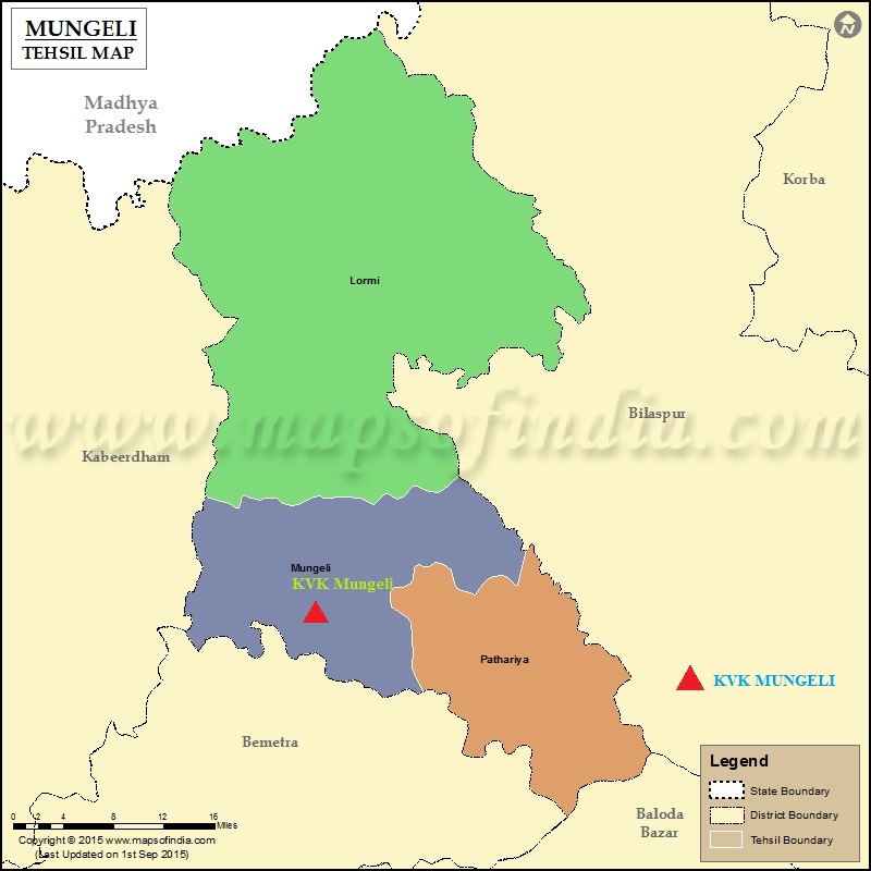
No. of block |
03 |
No. of panchayat |
301 |
No. of villages |
711 |
Literacy rate (%) |
64.7% |
Percent tribal population |
35.38%(SC), 10.37(ST) & 61.81(Other) |
Source- Department of Agriculture and Bio technology, Mungeli